Conservation Vision at Work
SkyTruth is automating image analysis for conservation.
NOTE: If you’d like to hear more about Conservation Vision please join me and a few of our experts at SkyTruth tomorrow (Thursday, October 29, 5-6pm Eastern) for an online presentation and Q&A we call Cutting Edge Conservation with SkyTruth. Click here [link removed, event has ended] to register in advance for this event – space is limited!
In early 2019 I announced Conservation Vision, a major new initiative at SkyTruth that uses cloud computing and machine learning to automate the analysis of satellite images. When this powerful approach is applied to the growing amounts of Earth images and data streaming down from space, it promises to revolutionize conservation efforts. Solutions that once could be applied to only a handful of images at a time on a desktop computer, now can be scaled to run on dozens or even hundreds of networked machines simultaneously, handling thousands of images covering the globe and spanning decades. New algorithms and ways of analyzing data can be rapidly developed, tested, and validated. And the results of those analyses can be provided quickly to those who have the power to take action.
Conservation Vision now encompasses much of SkyTruth’s work.
For the past two years our team has been hard at work developing and using these tools, making Conservation Vision a reality. Here are some of the ways we’re doing this:
Project Inambari: Detecting Illegal Gold Mining in the Amazon
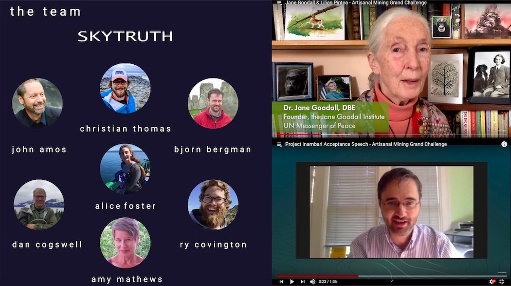
SkyTruth was announced as one of five winners of the Artisanal Mining Grand Challenge, a conservation technology contest organized by Conservation X Labs to address an expanding threat to rainforests and other tropical ecosystems around the globe. Our project applies a machine learning process to radar satellite images to automatically detect signs of artisanal (mostly illegal and unregulated) gold mining in the Amazon rainforest. Millions of miners have razed forest, destroyed river habitats with their sluices and dredges, and poisoned waterways with mercury to separate out flecks of gold from riverbanks. In addition to the damage to fish and wildlife, this practice threatens the health and livelihoods of Indigenous people who rely on the rainforest to survive. Our project, named Project Inambari for one river in Peru experiencing this devastation, relies on radar imagery because of its advantage over optical infrared imagery: it can pierce clouds, smoke and haze to give a clear picture of the ground whenever the satellite passes overhead. This is particularly important for early detection in often-cloudy rainforests, and for alerting authorities quickly so they can take action. You can learn more about this project and watch our award-winning pitch videos in our recent blog post.
Cerulean: Identifying Polluters at Sea
Thanks to a startup grant from Amazon that includes generous in-kind tech support, we’ve been making steady progress on Cerulean, a project that uses satellite imagery and data to automatically scan the ocean for signs of oil pollution and identify the perpetrators. Cerulean is now handling 1,500 new satellite images every day, detecting dozens of oily slicks around the world. These slicks are the telltale sign of bilge dumping from ships at sea — a flagrant violation of international oil pollution laws.
Mountaintop Removal Mining: Tracking Landscape Restoration and Recovery
Our mountaintop mining work is entering a new phase, building on the annual automated detection and mapping of new coal mining activity in Central Appalachia to evaluate the effectiveness of reclamation and revegetation of mined sites. We hope that this data will help identify a path forward for regenerating the damaged landscapes of Appalachia. Look for a new peer-reviewed paper on our work, co-authored by SkyTruth and Defenders of Wildlife, to be published soon in the online journal PLOS ONE.
Harmful Algal Blooms: Bringing Expert Knowledge from the Desktop to the Cloud
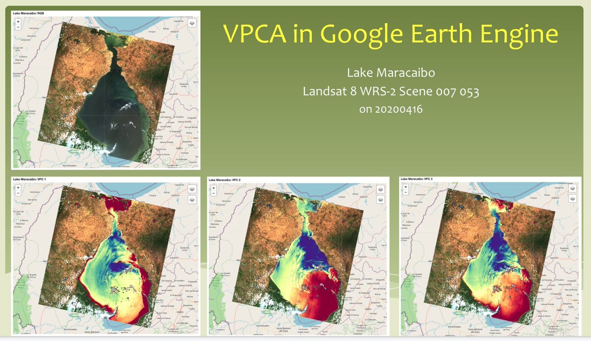
In collaboration with researchers at Kent State University (KSU), our cloud-computing experts scaled up a slow, cumbersome, complex approach to analyzing satellite images one at a time on a desktop computer, into a cloud-based program that can process thousands of images and identify the telltale signs of harmful algal blooms in lakes and coastal waters. This is a growing problem around the world, extracting a severe economic and public health toll. Our team replicated KSU’s analysis by reprogramming it in Python on Google’s Earth Engine cloud platform, and provided a series of online training sessions to the KSU team so they can continue to build on the model, offering the potential to create a global early-warning system for coastal managers. SkyTruth and KSU presented this work and co-hosted a workshop on water quality monitoring at the annual Google Earth Outreach conference last week.
KSU analysis of water quality in Lake Maracaibo, Venezuela, brought to the cloud with help from SkyTruth.
Where’s the Fracking?
In partnership with Wildlife Conservation Society we crafted a machine-learning model that analyzes multispectral satellite images to detect and map the footprint of oil and gas drilling sites in Argentina. This is critical information for wildlife biologists seeking to protect biodiversity in rapidly industrializing landscapes along the Andean front, and in sensitive regions like Patagonia. Unlike in the US where data on the location and timing of drilling is publicly available, in much of the world this information is private. Our team built on work we’ve done here in the US to accomplish this, and we are exploring opportunities to expand this approach to reveal the extent of drilling operations in other countries.
What do these projects all have in common? They’re all using advanced technology to accelerate the extraction of environmental information from satellite images, building new pathways for better management of natural resources and wild spaces, and creating opportunities for rapid response to head off environmental damage before it occurs.
Of course, it doesn’t make sense to do all this work if nobody but us can see the results. That’s why we typically make our analysis and products free for public use through our partners and our website. We’ve also been beefing up the SkyTruth Alerts system, adding features and functionality that have grown Alerts into a flexible, easy-to-use monitoring tool. Now anyone can interact with satellite images to keep an eye on the special places around the world that they care about — whether that’s a favorite fishing spot in the next county, a community suffering from air pollution next to an industrial facility, or a protected area that’s saving endangered tigers on the other side of the planet.
Last but not least: SkyTruth has a new look! We’ve totally overhauled the SkyTruth website, creating a new logo and easier navigation. I hope you’ll visit soon, and spend some time exploring. And while you’re there, please sign up to get an email notification whenever we publish a new blog post — it’s the easiest way to keep up with all the work we’re doing — and consider supporting SkyTruth by making a donation.
Our team would love your feedback on the site and logo, and I always appreciate hearing from you. Don’t hesitate to reach out. And please join us tomorrow evening!


