Satellite analysis shows steep increase in amount of land destroyed to mine a ton of coal in Appalachia
Today at 2:00 pm EST, the Open Access journal PLOS ONE published “Mapping the yearly extent of surface coal mining in Central Appalachia using Landsat and Google Earth Engine”. This paper, the product of a partnership between researchers at SkyTruth, Duke, and Appalachian Voices, provides the first comprehensive map of annual surface coal mining extent in Central Appalachia.
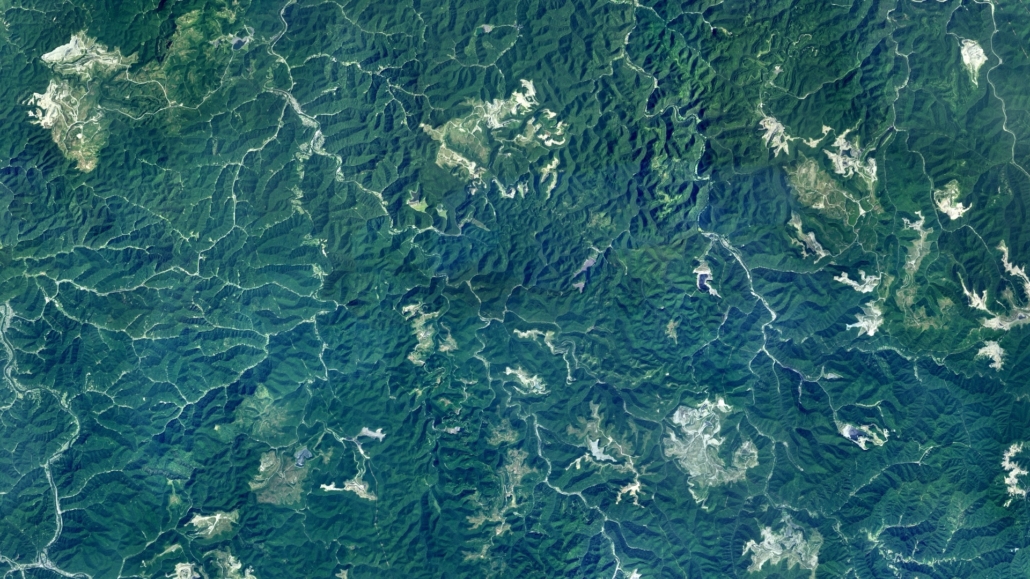
Mountaintop removal coal mining (MTM) is an immensely damaging practice which involves removing rock and soil which overlay coal seams using a combination of explosives and heavy machinery. The removed material is often deposited into valleys, in a practice known as valley fill. Mountaintop removal coal mining is responsible for disturbing thousands of square kilometers of land in Central Appalachia and is the region’s single largest source of land use change.

This animation shows the expansion of surface mining’s footprint (displayed in yellow) from 1985 to 2015 for a 31,000 square kilometer sub-region of the study area in West Virginia and Kentucky, and has county boundaries visible.
In addition to substantial disturbances directly visible on the surface of the land, MTM and subsequent valley fills have been shown to adversely impact stream health as seen by decreases in salamander abundance and aquatic macroinvertebrate diversity. MTM has also been associated with risks to public health in nearby communities, including higher rates of cancer and heart disease.
This study, published today, improves upon earlier SkyTruth work, and creates the first ever dataset of yearly active mining in Central Appalachia. Between 1985 and 2015 our study finds that 2,900 square kilometers (~720,000 acres) of this typically forested region has been cleared as a result of MTM. Coupling our results with our earlier work which dates back to 1976 we find that 5,900 square kilometers (~1.5 million acres) of Central Appalachian forest has been cleared. This is an area 18% larger than the state of Delaware, and roughly 3 times larger than the Great Smoky Mountains National Park.

This image shows a snippet of code used to create the annual mining footprint data, which is visualized in the bottom section of the image. Older mining in this visual is red; newer mining is yellow.
In addition to determining the spatial extent of MTM in Central Appalachia, the study also examined the relationship between the area of land being mined to coal production as reported to the United States Mine Health and Safety Administration (MSHA). Over the course of this study period (1985-2015) we see a threefold increase in the amount of land cleared to extract an identical quantity of coal (from 10 square meters of land per metric ton in in the 1980’s to 30 square meters in 2015).
This dataset is freely available for the public to download, visualize, and analyze the footprint of mining in Central Appalachia. To access all the data, please visit: https://skytruth.org/mtr-data-files/. To explore a subset of the data via an interactive web map, please visit: https://skytruthmtr.appspot.com/.
[The Mountain Top Removal visualization tool has been retired, but the MTR data is updated annually.]

