Taylor Energy Site – Leaking Oil Continuously Since 2004
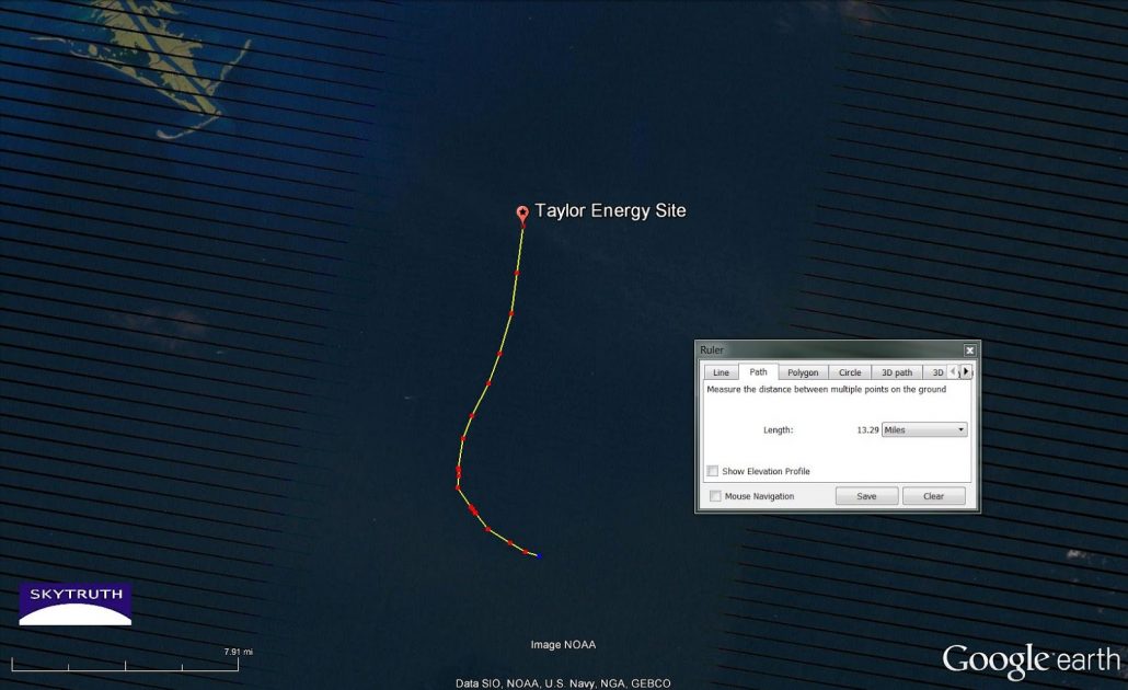
It’s been a while since we posted on the chronic oil leak from the Taylor Energy site just off the tip of the Mississippi Delta in the Gulf of Mexico. Sad to say, nothing has changed: oil is continuing to flow unabated, as shown by the 13-mile-long slick in this Landsat-7 satellite image that was taken Wednesday morning:

Detail from Landsat-7 satellite image acquired January 7, 2015, showing 13-mile-long slick apparently emanating from Taylor Energy site. (Black lines at left and right sides of the image are data gaps caused by 2003 failure of the scan-line corrector on the Enhanced Thematic Mapper sensor.)

Same image as above, without annotation. Slick is visible as faint dark streak on this unenhanced true-color image.

In case the slick is too hard to see, here is a 3-2-1 contrast-enhanced image. The colors are bit odd because of high-cirrus clouds, scan-lines, and the enhancement process.
As far as we can determine, there is no plan by the responsible party, the oil and gas industry, the US Coast Guard or the EPA to permanently fix this leak and stop this ongoing pollution of public waters.
This is not a big leak: it seems to be somewhat larger than the most productive natural oil seeps that are scattered in deep water throughout the central and western Gulf. So maybe “no action” is a practical decision to make. But shouldn’t the public get to participate in making that decision?

