Pollution Response Activity in Campos Basin off Brazil?
We’re still trying to figure out what caused that big smoke plume we saw in the Marlim Sul oil field of the Campos Basin, about 70 miles off the coast of Brazil, on a December 31 satellite image. So far, we’ve looked at data showing the locations of active exploration wells (where we would expect to see a drill rig at work); active oil production platforms, including FPSOs; and vessels broadcasting an AIS signal; and we can’t identify anything at the location where the smoke plume originates:

Detail from December31, 2013 MODIS satellite image showing smoke plume off coast of Brazil in the Campos Basin oil field. Source of smoke plume shown by red marker. Nearby / notable drill rigs and platforms shown by yellow markers. Other oil platforms shown as purple dots.
So we are still stumped by this incident. If any of you want to lend a hand, the smoke plume’s point of origin is here:
( 22°36’15.65″S / 40° 3’55.63″W)
Meanwhile, our investigation has turned up something else of interest.
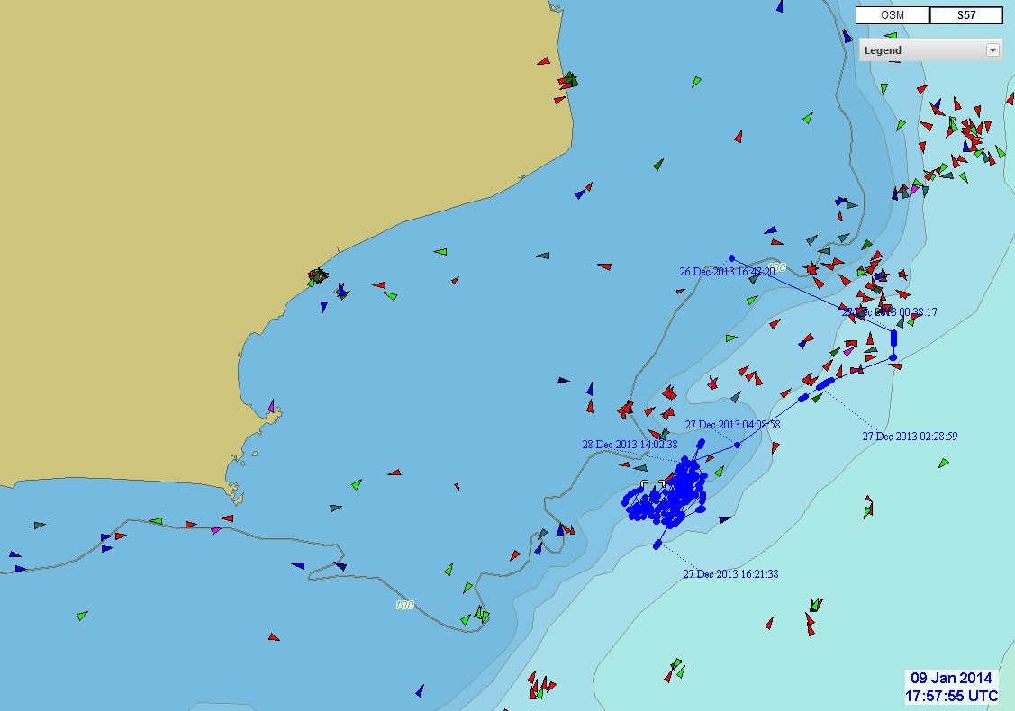
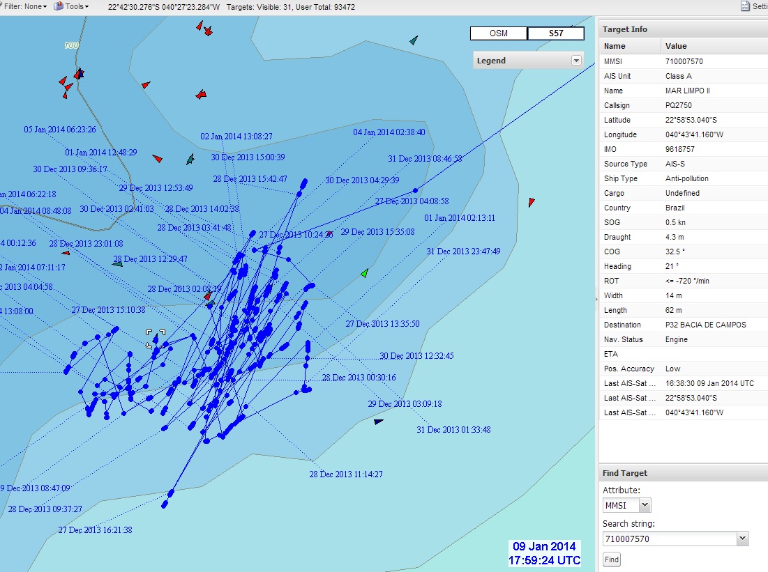
We’re using global satellite AIS data to track vessels around the world, as part of our work to monitor marine protected areas and detect illegal commercial fishing activity. We spotted an oil spill response vessel, the Mar Limpo II, operating in the Campos Basin about 45 miles southwest of the smoke-plume location. Judging by its repeated back-and-forth track, it looks like the vessel is actively engaged in oil spill response, possibly skimming oil and/or applying chemical dispersant to an oil spill:

Map of Campos Basin off Brazil, showing vessel AIS data. Track of the oil pollution response vessel, the Mar Limpo II, is shown in blue. Image Credit © exactEarth

Detail from above showing the back-and-forth motion of the Mar Limpo II. Current position (January 9) of the vessel is indicated by square white brackets. Vessel appears to be engaged in oil spill response. Image Credit © exactEarth
If anyone has information about a possible spill here, please let us know.


