Two Satellites Capture Evidence of Pipeline Bombing in N. Iraq
Detail of a MODIS image from the Terra satellite. See the originals here.
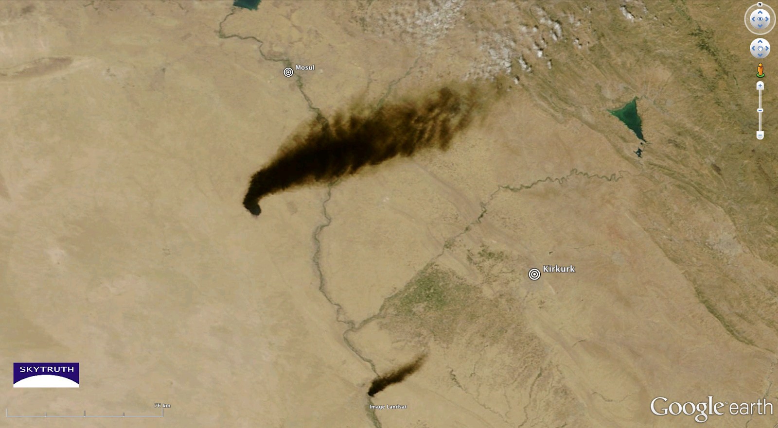
August 23, 2013, Shepherdstown, WV – A plume of black smoke from burning oil can be seen extending for miles across the Iraqi desert from a source believed to be a major pipeline bombing. On the morning of August 21, NASA’s Terra Satellite detected an 85 mile-long smoke plume from the main source west of al-Kuwayur, and a smaller 20 mile-long plume near Baiji. The plume was more than 200 miles long, overshadowing Miandoab, Iran, when NASA’s Aqua satellite passed overhead later in the day. A local report indicates that oil has reached the Tigris River and threatens the water supply throughout the Salahaddin Province.

Region-wide view later in the afternoon; the plume may actually extend more than 200 miles, but Aqua’s image swath did not catch the entire plume.
More hi-resolution images are available: (Sorry, our Flickr account is out of commission right now)
Terra – Region-wide (including Baghdad)
SkyTruth regularly monitors satellite images and remote sensing data to document issues that impact environmental and public health. In this instance, communities nearby and downstream are subject to water pollution, while people who live downwind are exposed to heavy air pollution, even though they live hundreds of miles from the source. These technologies we use allow us to document what happens when vulnerable fossil fuel infrastructures are damaged, either by an act of war, or by accident. While the BP/Deepwater Horizon disaster was the biggest accidental oil spill in history, the worst oil catastrophe in history was set by Saddam Hussein’s troops retreating from Kuwait at the end of the first Gulf War.
In the end, however, the damage done to the environment and the people subjected to the pollution remains the same, whether the cause was accidental or intentional.
