Mismatched reports about Site 23051 chronic oil spill in Gulf
So, who can you believe?
According to the July 12 NRC report about the oil leaking from Site 23051, there was a spill of 7.43 gallons of oil with a visible sheen reported to be 9.3 miles in length and 200 feet wide. This report was based on observations during an overflight that occurred at 8am that day. Taylor Energy is required to fly over the site every day and report any oil in the water. We assume this is the report filed by Taylor or their contractor. Our SkyTruth Alert calculations suggest that a slick of that size should hold about 241 gallons of oil (we assume a minimum average oil slick thickness of 1 micron).
But there’s more. A “Good Samaritan” passerby (another helicopter pilot) sighted a slick 15 miles long at 2:10pm, at a location about 15 miles northeast of the Taylor leak site. This report prompted the Coast Guard to request an investigation and oil slick trajectory forecast from NOAA. We think the passerby sighted the far end of the Taylor slick.
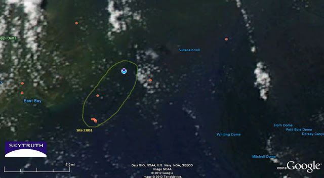
If you look carefully at the MODIS satellite image below, taken at about 1:45pm, you can see a faint, dark streak apparently emanating from Site 23051 that appears to connect to the location of the Good Samaritan’s report. We think this is the slick reported both by Taylor and by the Good Samaritan, and we think It’s unlikely that the slick grew 6 miles in length in the 6 hours that elapsed between the Taylor report and the Good Samaritan’s report (and corresponding MODIS satellite image).
Yet another reason we’ve become increasingly skeptical about the accuracy of the reports submitted by Taylor, and critical of our nation’s reliance on polluter-submitted reports overall.


