Slicks in Campos Basin, Offshore Brazil – March 20, 2012
Brazil is coming down hard on Chevron for the relatively modest oil spill that occurred last November when they lost control of a deepwater exploration well in the Frade field of the Campos Basin, about 75 miles offshore. A federal prosecutor just filed a lawsuit and criminal charges against Chevron and their drilling contractor Transocean. Seventeen executives of those companies have also been charged.
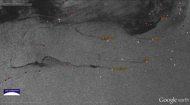
Brazil’s President has made it clear that the country will treat all oil companies, domestic and international, the same when it comes to safety. Petrobras, the Brazilian national oil company, is the main operator in Brazilian waters, and they’ve had their own share of problems lately. We’ve observed small slicks from Petrobras facilities since we started our daily monitoring of this area a few months ago. And this Envisat ASAR radar satellite image of the Campos Basin, taken at 9:18 pm local time on March 20, shows what appear to be long, narrow slicks emanating from several Petrobras production platforms and FPSOs:

Detail from Envisat ASAR radar satellite image of Campos Basin off Brazil, taken March 20, 2012. Oil production platforms and FPOs indicated by colored dots. Possible oil slicks (dark streamers) appear to emanate from several facilities, shown in orange. Image courtesy European Space Agency.
This is a complex image. Platforms, FPSOs, drill rigs and vessels appear as bright spots on radar. The large, indistinct dark areas in the upper part of the image are also slicks, but not caused by oil (a “slick” is any patch of smooth water, appearing dark on a radar image). Instead, these patches are probably caused by areas of very low wind speed, and/or by heavy rainfall. Sea-surface wind data, taken almost the same time as the radar image above, indicate there was unsettled stormy weather in the area:
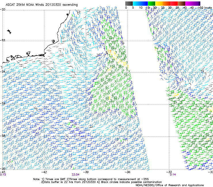
Surface wind speed and direction derived from satellite radar scatterometer data, offshore Brazil, at about 8 pm local time on March 20. Black flags indicate possible rainfall.
More images and maps after the jump….
Chevron’s Frade field is covered by the same March 20 radar image. No slicks are apparent in the vicinity of the spill that occurred last November, where Transocean’s SEDCO 706 semisubmersible rig was drilling a deepwater exploration well for Chevron:
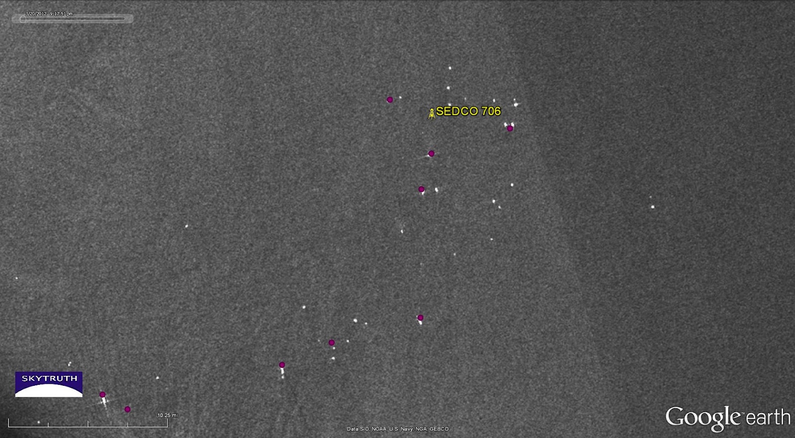
Detail from March 20, 2012 Envisat ASAR radar satellite image showing vicinity of Chevron’s November 2011 oil spill in the Frade field of the Campos Basin. No slicks are apparent in this area. Locations of production platforms and FPSOs are shown as colored dots. Image courtesy European Space Agency.
However, sea-surface wind speed data indicate that strong winds moved through the Frade field (located at about 22 degrees South latitude / 39 degrees West longitude) in the day before the radar image was acquired. These winds, and the rain that probably accompanied them, were strong enough to disperse the thin oil slick that was reported recently at Frade:

Surface wind speed and direction at about 7:30 am local time on March 20, offshore Brazil. Black flags indicate possible rainfall.
