Campos Basin Oil Spill, Brazil – Slicks Dissipating?
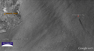
Envisat ASAR image of Campos Basin taken November 22, 2011. Surface winds too strong to reliably detect thin oil slicks. Bright spots are vessels and oil platforms. Image courtesy European Space Agency.
Today’s Envisat ASAR satellite radar image of the Campos Basin, covering the location of the Chevron / Transocean oil spill, shows no sign of an oil slick. It was taken at about 9:30 am local time.
However, the wind speed was fairly strong in the area at the time. According to the satellite scatterometer data collected by the ASCAT system, surface winds were blowing at 15-25 knots (8-13 meters per second). This is strong enough to overwhelm very thin oil slicks (the optimum wind speed for detecting slicks on radar images is about 3 – 10 meters per second):
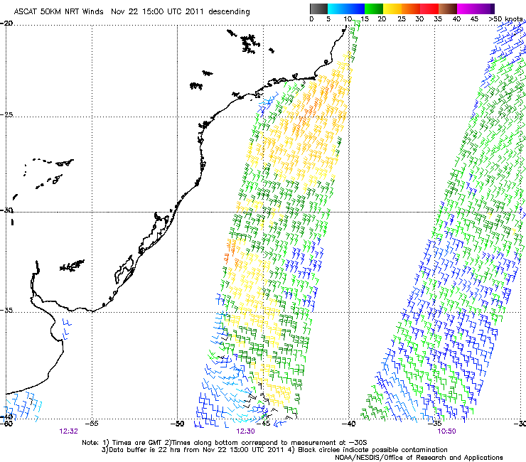
Surface wind speed and direction derived from ASCAT scatterometer data at nearly the same time as the November 22 radar satellite overpass.
So it is possible that very thin oil slicks remain in the area, but it is encouraging that we don’t see signs of thick oil…
(more text and images after the break)
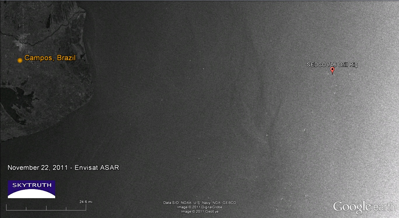
An ASAR image taken on November 11 under more favorable wind conditions (5-8 meters/sec) clearly shows a 20-mile-long slick originating near the location of the SEDCO 706 rig:
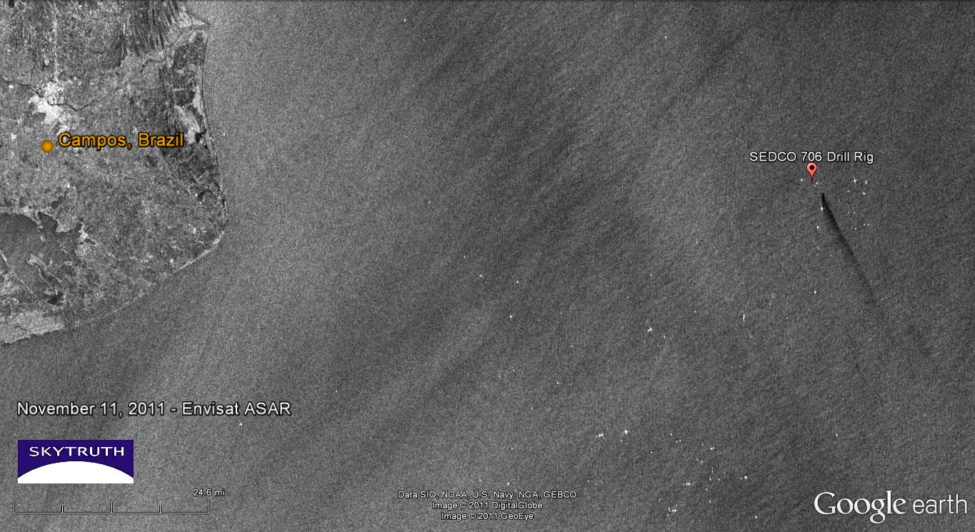
Envisat ASAR image taken November 11, 2011. Image courtesy INPE.
And this radar image taken on November 14 shows a 27-mile-long slick on the site. Sea-surface wind speed measured in the vicinity was favorable in the morning but excessive (13-15 meters/sec) in the evening, so the thinnest parts of the slick may not be visible on this image:
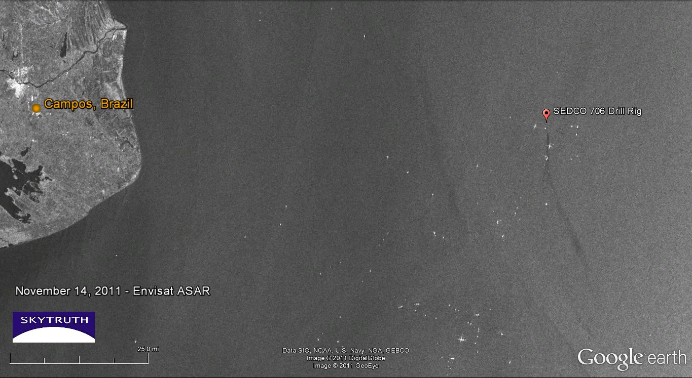
Envisat ASAR image taken November 14, 2011. Image courtesy INPE.
We are cautiously optimistic that this spill has been brought under control. We’re hoping for a few more radar images in coming days, taken under moderate wind conditions. We will update you here when we see anything interesting.


Hi John.
This video has been released today by IBAMA (Brazilian Environmental Ministry): http://bit.ly/uxfybl
as well as more info here: http://www.ibama.gov.br/publicadas/novas-informacoes-dos-orgaos-federais-sobre-sobre-vazamento-de-oleo-na-bacia-de-campos
you may have to use a CAT tool in order to translate it.
take care, Mia.
Thanks again Mia for this great information. The video shows the seafloor leaks on November 19 and 22; the area shown shows a slow trickle of oil droplets emanating from a line on the seafloor. It may take some time for this slow leakage to subside, so we can expect to see small slicks on the ocean surface in this area for a while.
No problem. : )
If I find something relevant I'll come back here. You might have better links from the scientific community anyway.
Shame though as it is a pretty area (although far from any town), besides with spring/summer it is whale mating season I believe.. too bad.
All the best!
Thanks for this post!