
Marsh Fire Near New Orleans – Smoke Plume Over City
A quick update – yesterday’s MODIS satellite image shows the plume of smoke from a burning marsh blowing to the south-southwest, affecting a big chunk of the city of New Orleans and parts of the Jefferson, Lafourche and Terrebonne parishes:
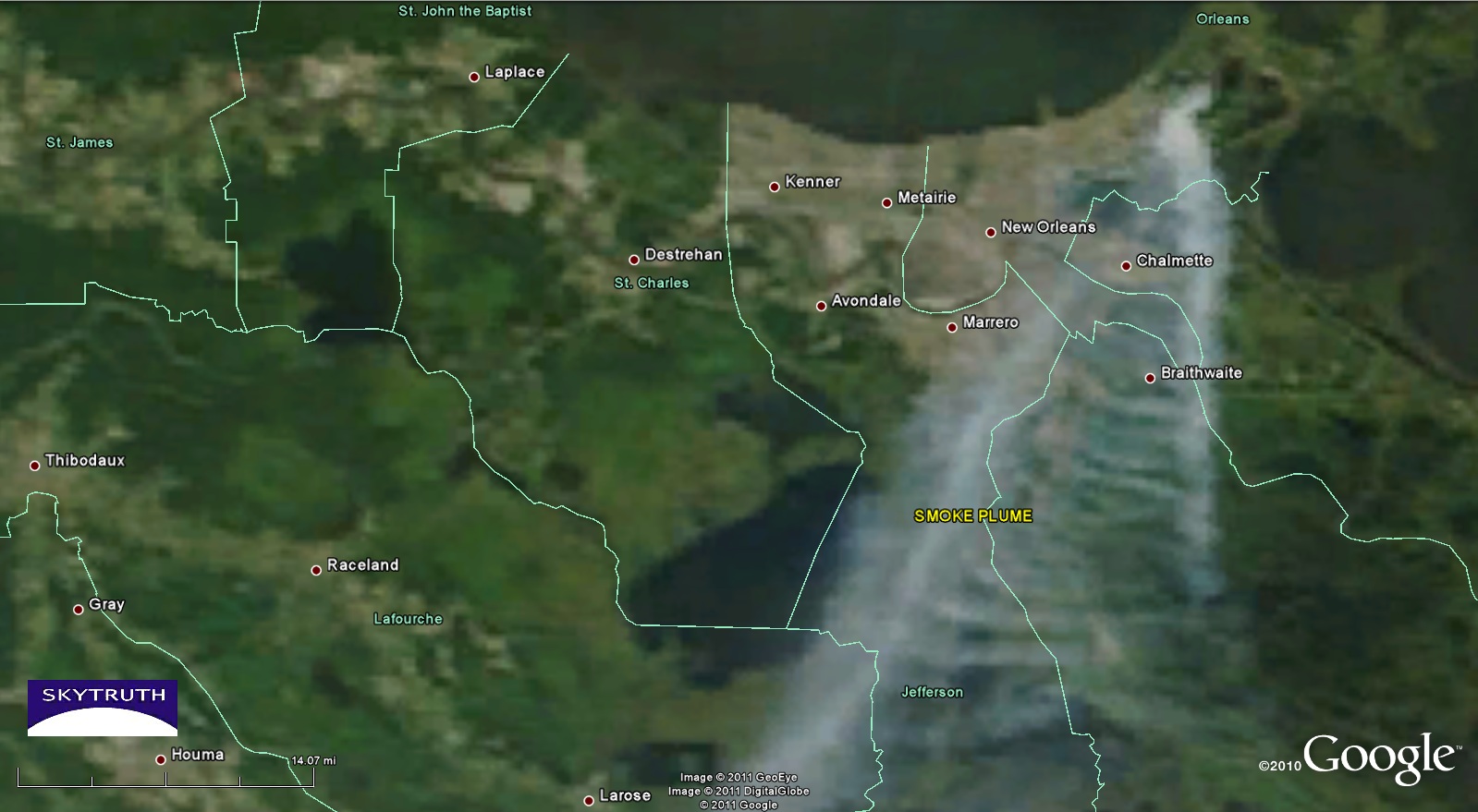
Detail from MODIS satellite image taken August 28, 2011 showing smoke from burning marsh drifting over eastern and southern new Orleans.
Thick smoke was drifting yesterday over the communities of Chalmette, Braithwaite, Marrero, Galliano, Chauvin, Dulan and Theriot, then heading out over the Gulf, making a visible plume that extended nearly 300 miles from the source of the fire – much longer than the smoke plume we observed while the Deepwater Horizon rig was burning last April.

