BP / Gulf Oil Spill – Tropical Storm Alex Makes a Drive-By
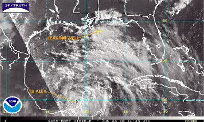
This GOES weather satellite image of the Gulf of Mexico shows Tropical Storm Alex at 6:45am Central time. Alex has just entered the southern Gulf after moving west across the Yucatan Peninsula:
GOES weather satellite image, June 28, 2010
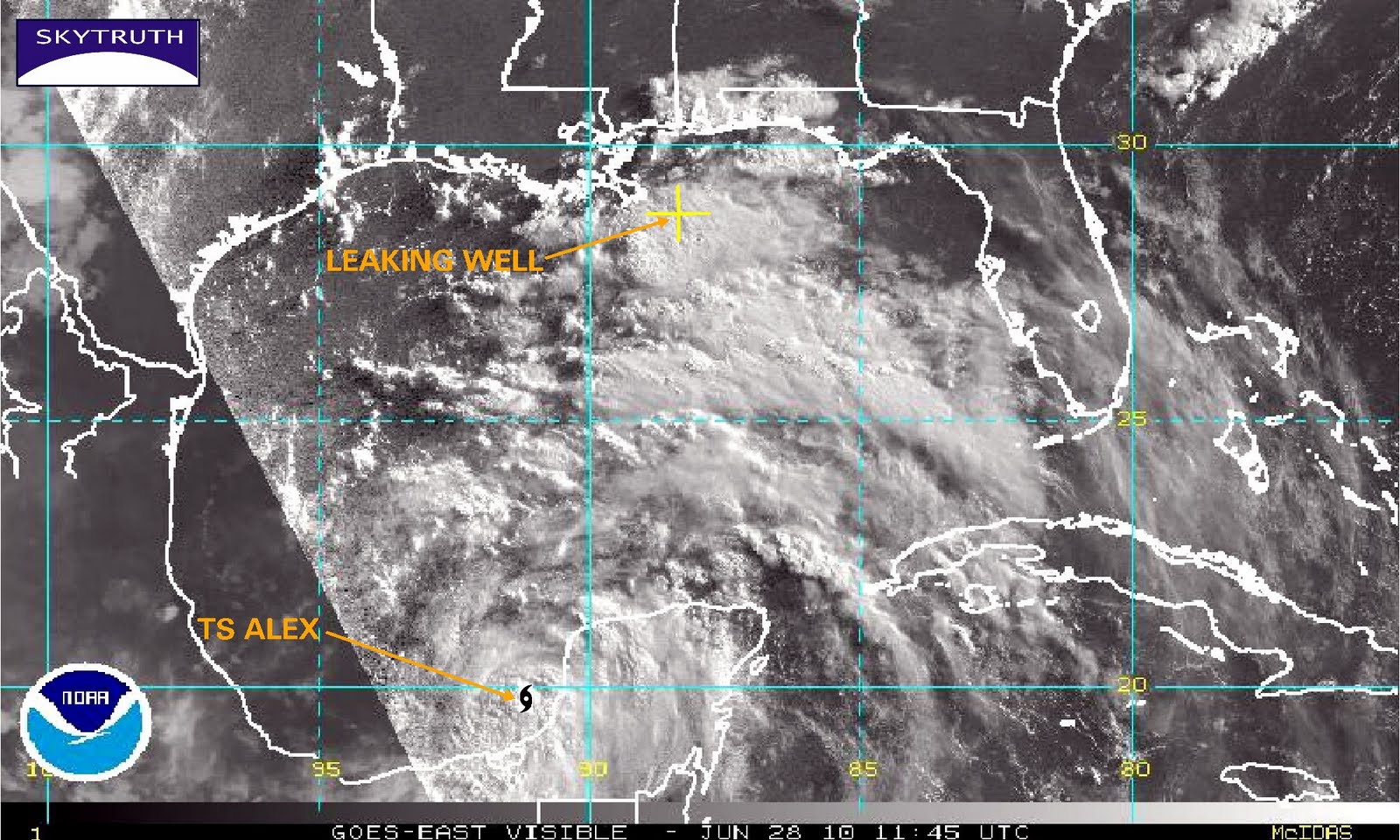
Large bands of clouds containing strong thunderstorms are moving into the northern Gulf and affecting the area of the leaking Macondo oil well, raising the anxiety level surrounding the cleanup and response operation, but Alex is forecast to move steadily northwest, making landfall around the Texas-Mexico border:
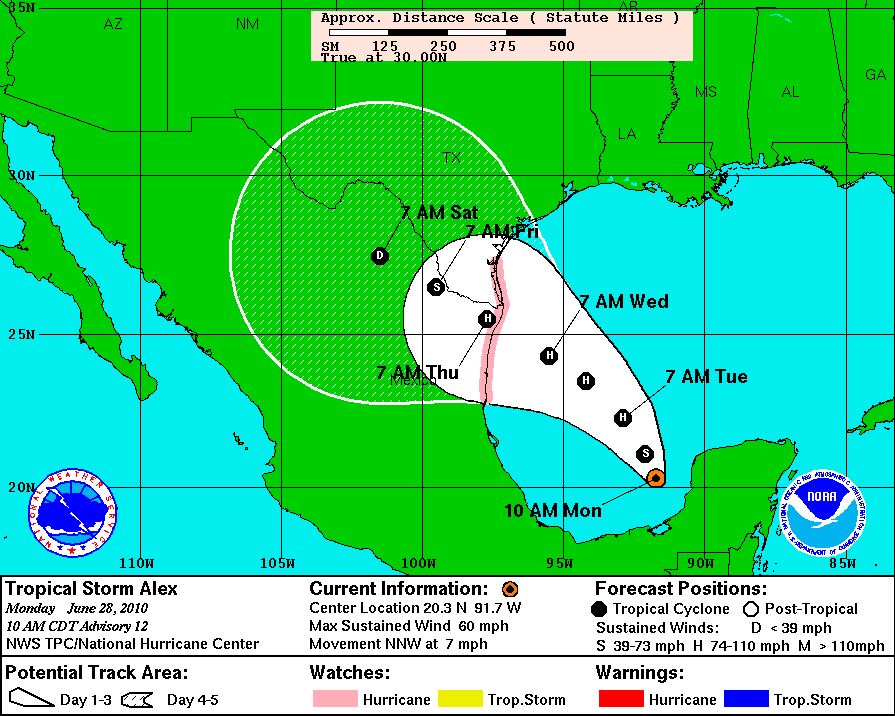
NOAA forecast track for Tropical Storm Alex as of 10am CDT, June 28, 2010
Storm fans: see an animated loop of Alex’s progress.

