BP / Gulf Oil Spill – Radar Image, May 13, 2010
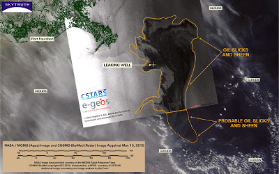
NASA/MODIS images have been too cloudy to be much use for May 12 and 13 (see the most recent image we processed, for May 11). But a radar image taken by the Italian COSMO-SkyMed system clearly shows most of the slick in stark detail:
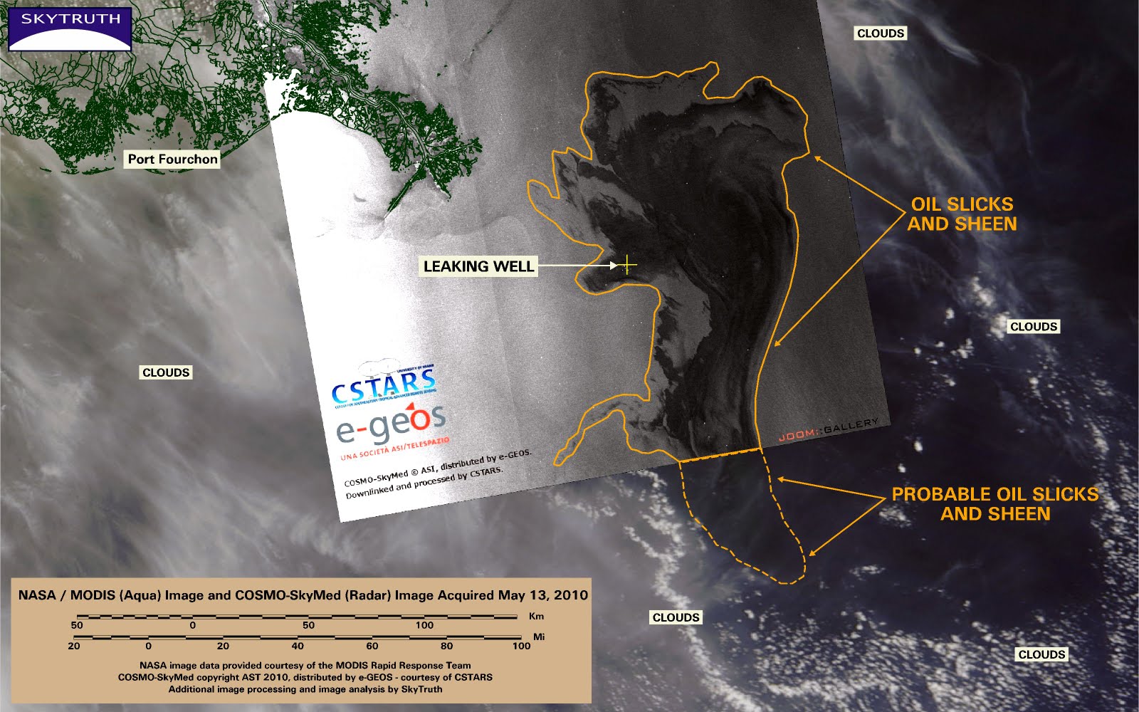
COSMO-SkyMed radar image (black-and-white) superimposed on cloudy NASA/MODIS image. Both images taken May 13, 2010. Radar image courtesy CSTARS.
The slick covers 4,922 square miles (12,748 km2) on the radar image, and is within about 25 miles of the Delta shoreline. The slick clearly extends south beyond the edge of the radar image; hints of it are visible on the MODIS image through the clouds and haze.See all the images in our Flickr gallery.


You cats so ROCK in'da USA!
And no one has yet to assail your math! So there.
And now NPR is running this article with Steven Wereley that totally backs your estimates. Whoa. Get Down, Get Back Up Again.
SkyTruth Rules!
Anyway, thank you so much for getting on the ball so early in this game.
And uherrah did I say your math remains UnAssailable? Ahem!
We have you hangin'5X5 on the Ladder.
Editilla~New Orleans Ladder
http://noladder.blogspot.com/
Thanks NOL! Nice poetry by the way.
Our estimates now look quite conservative.
We need more hair to contribute, hope this mess would be solved as soon as possible for it had caused a big damage, anyways your blog is absolutely amazing thanks for giving out further updates about the situation
Angel Baluyut,
green companies