
Gulf Oil Spill Covers 817 Square Miles
NASA/MODIS satellite image taken April 25 showing oil slicks from Deepwater Horizon disaster.
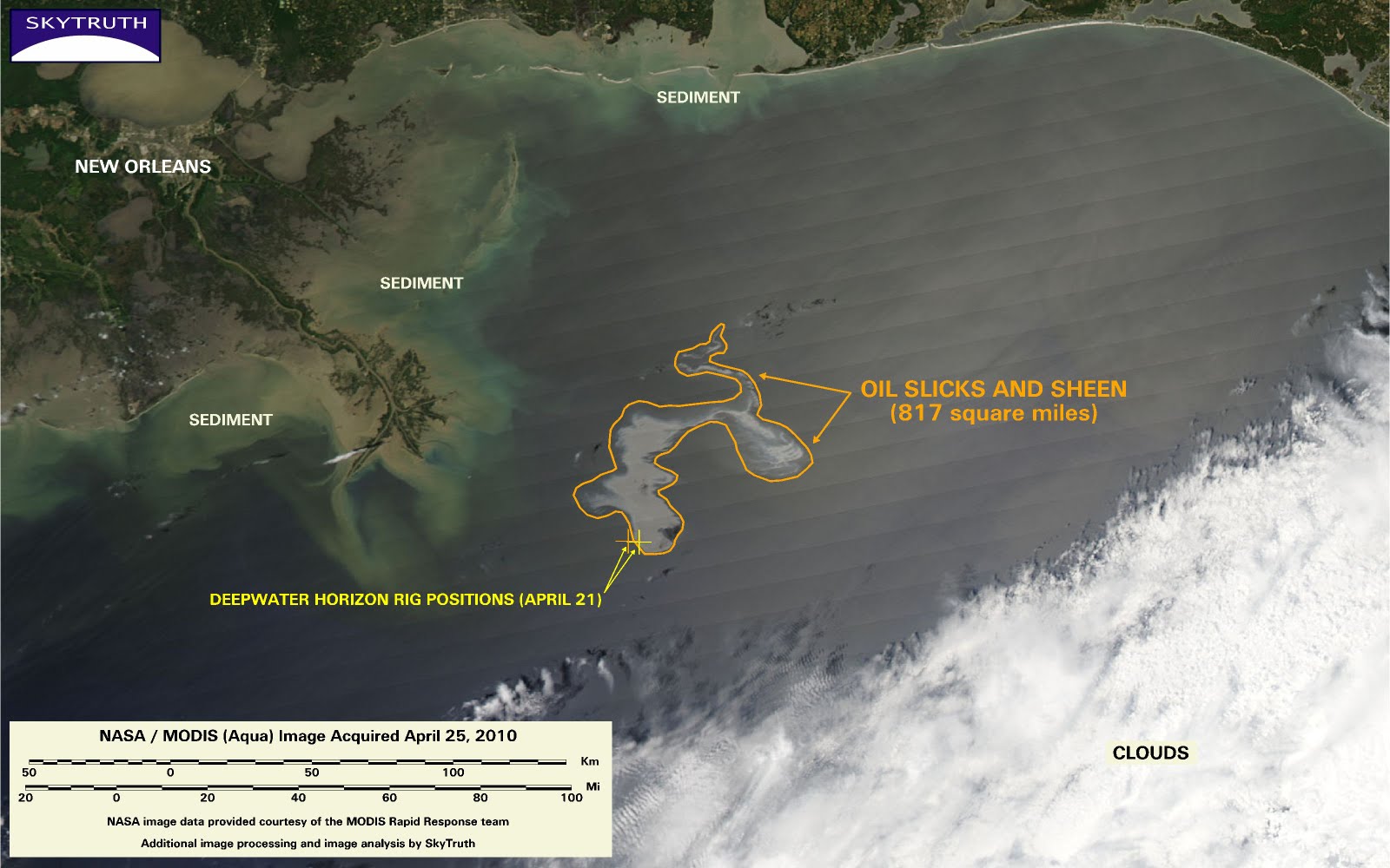
SkyTruth just processed a NASA/MODIS satellite image of the Gulf of Mexico that was taken early yesterday afternoon (April 25). Slicks and sheen (very thin slick) covers about 817 square miles, and reaches 50 miles away from the assumed point of origin (the site of the leaking well on the seafloor). We’ve posted this in our image gallery for this incident. We’ve also shown the last two positions of the rig that we were able to detect before it sank, as seen on NASA images from April 21 (also in our gallery).
UPDATE 4/27/10 1pm – We’ve added a very detailed image to our gallery, also taken on April 25, from NASA’s Advanced Land Imager (ALI) sensor carried on the Earth Observing-1 (EO-1) satellite. You can see response vessels, and gradations in the thickness of the slick and peripheral sheen. Meanwhile, the spill continues unabated, and the size of the oil slick has more than doubled since these NASA images were taken just two days ago. We hope to get new images soon.

